Wednesday 24th August, 2011
I had a leisurely start to today as I had no need to rush anywhere. I spent the morning walking out to the sea lock at Clachnaharry. This is about a 5 mile round trip and meant that not only had I followed the Great Glen Way in its entirety, but also the Caledonian Canal. The path all the way to the sea lock was busy with dog-walkers, joggers, boats, and residential and business premises. It was a gloriously warm and sunny day and a lovely end to my walk. Except it wasn't the end really, as I still had to get to Inverness Castle.
Back near the campsite I called in at Floral Hall coffee shop for lunch. This is a botanical garden, but as there was an admission charge and I didn't know how much time I'd need to look round it properly, I didn't go in. I'll save it for another time.
I went back to the campsite and spent a bit of time lying around reading before getting packed up for the walk across the Ness Islands to Inverness. The Ness Islands are set in the River Ness and joined by a series of bridges. They are all covered with woodland and make a pleasant park area for the people of Inverness. Finally the path reached Inverness proper and climbed upwards along roads to reach the castle and the GGW start/finish sign.
Once I'd taken the obligatory photos I headed for the train station and sat in the bar with a well-deserved beer before getting the train back to Glasgow.
Distance walked = about 7 miles (2 'official' miles plus the 5 miles to the sea lock and back)
Showing posts with label Great Glen Way. Show all posts
Showing posts with label Great Glen Way. Show all posts
Tuesday, 30 August 2011


GGW day 6
Tuesday 23rd August, 2011
The final day of the walk proper. I got the same bus as I'd got yesterday morning, but because I was only going as far as Drumnadrochit I was able to start walking a lot earlier.
The path starts by following the A82. At first alongside the road but then on a separate path. A couple of miles in and the path started to climb away from the road. The path joins a forest road and I followed this to the highest point on the whole GGW at 375m. The road then descended for a way to get to Abriachan. This is a kind of woodland outdoor centre with a car park, picnic tables, eco toilets, and lots of bird houses and sculptures. I stopped here for lunch.
A short while further on I bumped into the Canadians again (we'd been passing each other all day) as they were emerging from what seemed to be overgrown brushland. There is a campsite and cafe hidden away in it and they'd just stopped for a cup of tea. Curious, even though I'd already eaten, I picked my way through boggy paths to find it. It's quite a bizarre place run by an eccentric couple. It seems overgrown yet is actually maintained with fruit and veggies growing, chickens roaming about and a pond. I had a freshly squeezed orange juice (yum, vitamins - something I felt I was lacking living on instant noodles and cup-a-soups) and chatted to the couple.
They've owned the land for a few years and live in a caravan on it. They started offering camping as way of getting people to camp officially rather then wild camping and using what is essentially their garden, as a toilet. I got an elaborately hand-written receipt for my orange juice; something to do with placating the tax man.
The path continued on the level and then met the road which I followed across the Abriachan plateau for a couple of mile or so. Then I joined a path which rises again and got my first views of Inverness in the distance. The path began descending and entered a forest through which I walked for several miles. The path then drops steeply into Inverness. I had to stop several times to give me knees a break. Once on the outskirts of Inverness I was back to walking through a housing estate just like at the beginning of the walk.
The path joins the canal again near the campsite. I was about 2 miles (if that) from the end of the walk at Inverness Castle but didn't see the point in walking past the campsite into Inverness, just to walk back out the campsite again, and then walk back in again tomorrow to get the train. So I went straight to my tent instead.
Distance walked = about 16 miles.
The final day of the walk proper. I got the same bus as I'd got yesterday morning, but because I was only going as far as Drumnadrochit I was able to start walking a lot earlier.
The path starts by following the A82. At first alongside the road but then on a separate path. A couple of miles in and the path started to climb away from the road. The path joins a forest road and I followed this to the highest point on the whole GGW at 375m. The road then descended for a way to get to Abriachan. This is a kind of woodland outdoor centre with a car park, picnic tables, eco toilets, and lots of bird houses and sculptures. I stopped here for lunch.
A short while further on I bumped into the Canadians again (we'd been passing each other all day) as they were emerging from what seemed to be overgrown brushland. There is a campsite and cafe hidden away in it and they'd just stopped for a cup of tea. Curious, even though I'd already eaten, I picked my way through boggy paths to find it. It's quite a bizarre place run by an eccentric couple. It seems overgrown yet is actually maintained with fruit and veggies growing, chickens roaming about and a pond. I had a freshly squeezed orange juice (yum, vitamins - something I felt I was lacking living on instant noodles and cup-a-soups) and chatted to the couple.
They've owned the land for a few years and live in a caravan on it. They started offering camping as way of getting people to camp officially rather then wild camping and using what is essentially their garden, as a toilet. I got an elaborately hand-written receipt for my orange juice; something to do with placating the tax man.
The path continued on the level and then met the road which I followed across the Abriachan plateau for a couple of mile or so. Then I joined a path which rises again and got my first views of Inverness in the distance. The path began descending and entered a forest through which I walked for several miles. The path then drops steeply into Inverness. I had to stop several times to give me knees a break. Once on the outskirts of Inverness I was back to walking through a housing estate just like at the beginning of the walk.
The path joins the canal again near the campsite. I was about 2 miles (if that) from the end of the walk at Inverness Castle but didn't see the point in walking past the campsite into Inverness, just to walk back out the campsite again, and then walk back in again tomorrow to get the train. So I went straight to my tent instead.
Distance walked = about 16 miles.
GGW day 5
Monday 22nd August, 2011
Up early and trekked to the bus stop. It's quite frustrating having to walk all the way round - walking past my tent 10 mins after I've just left it! I can understand why there's no gate at this end of the campsite because if there was anyone could walk in and there could be quite a security issue. But I'm sure they could have put the vehicleless field nearer the main gate!
The bus back to Invermoriston was a lot more expensive than the one I'd got yesterday. Apparently there are different companies running the routes and they all have different prices. Oh well, it's worth it, not to be carrying my heavy pack. I still have the pack with me as I don't have a daypack with me, but it's almost empty and really light.
Once in Invermoriston I bought a sandwich for breakfast and sat in the shop's garden to eat it. A couple of friendly cats joined me. I wandered round Invermoriston for a few minutes (really, that's all it took) and bumped into the Canadian women again. The men had already set off walking (I saw them several times throughout the day), the women were taking the day off and going to get the bus to Urquhart Castle instead.
The path begins by climbing very steeply along a narrow road behind the shops. In no time at all I was well above them. The path continued to zigzag upwards, though not quite as steeply. It climbs about 215m in the the first mile. It then drops to about 110 metres. The path joins a forest road and continues to descend until it comes alongside the A82. The forest road then climbs again to about 300m before dropping down again to 120m. At least I couldn't complain about it being flat today!
The path climbs again towards Grotaig where it joins a small road. There are some paths at the side of the road, but a lot of the time I was walking on the road itself. This section is about 3 miles long and was very hard on my feet. Then I turned to descend on a gravel path before reaching the A82 and following this into Drumnadrochit.
Drumnadrochit is the main hub for all things Nessie. There are a couple of Nessie exhibitions and lots of cafes and shops. I was too late and too tired to do much more than wait for the bus though.
Distance walked = 14 miles
Up early and trekked to the bus stop. It's quite frustrating having to walk all the way round - walking past my tent 10 mins after I've just left it! I can understand why there's no gate at this end of the campsite because if there was anyone could walk in and there could be quite a security issue. But I'm sure they could have put the vehicleless field nearer the main gate!
The bus back to Invermoriston was a lot more expensive than the one I'd got yesterday. Apparently there are different companies running the routes and they all have different prices. Oh well, it's worth it, not to be carrying my heavy pack. I still have the pack with me as I don't have a daypack with me, but it's almost empty and really light.
Once in Invermoriston I bought a sandwich for breakfast and sat in the shop's garden to eat it. A couple of friendly cats joined me. I wandered round Invermoriston for a few minutes (really, that's all it took) and bumped into the Canadian women again. The men had already set off walking (I saw them several times throughout the day), the women were taking the day off and going to get the bus to Urquhart Castle instead.
The path begins by climbing very steeply along a narrow road behind the shops. In no time at all I was well above them. The path continued to zigzag upwards, though not quite as steeply. It climbs about 215m in the the first mile. It then drops to about 110 metres. The path joins a forest road and continues to descend until it comes alongside the A82. The forest road then climbs again to about 300m before dropping down again to 120m. At least I couldn't complain about it being flat today!
The path climbs again towards Grotaig where it joins a small road. There are some paths at the side of the road, but a lot of the time I was walking on the road itself. This section is about 3 miles long and was very hard on my feet. Then I turned to descend on a gravel path before reaching the A82 and following this into Drumnadrochit.
Drumnadrochit is the main hub for all things Nessie. There are a couple of Nessie exhibitions and lots of cafes and shops. I was too late and too tired to do much more than wait for the bus though.
Distance walked = 14 miles
Monday, 29 August 2011
GGW day 4
Sunday 21st August, 2011
This morning even though it was Sunday the shops were open and the tourists were out in force. I only had 8 miles to go today, but my pack was feeling heavy and my feet were feeling weary. This was the first day where it wasn't flat and I was looking forward to a bit of inconsistency in the terrain.
I was now following Loch Ness and would do until almost the end of my walk. Loch Ness is one of the largest lochs, only Loch Lomond has a larger surface area. By volume however, it is by far the largest, containing more fresh water than all the lakes in England and Wales combined. It is just under 23 miles long and is 1.7 miles across at its widest point. Loch Ness is of course famous for its monster, but though I kept a good look out I didn't catch so much as a fleeting glimpse of it.
Leaving Fort Augustus, the path immediately began to climb. It follows minor roads for a while, but is soon on forest tracks. The path kept its height with a few undulations. It was hard to see the loch for a lot of the time because of the tree cover. But it was also hard to hear (and see) the traffic down below on the busy A82, something which I'm not complaining about. Every now and again there would be a break in the trees and the chance to stop and drink in the view.
At one such viewpoint I was perched on a conveniently placed large, flat rock enjoying coffee from my flask when two older Canadian couples came along. They were walking the path too, but staying in B&Bs and using a baggage carrying service. I chatted for a while before moving on. I continued to see them on and off throughout the rest of the day.
As it got towards the end of the day I felt I was beginning to tire of carrying my back. The next two days are long days with a lot of hills and a lot of miles and I wasn't sure how I'd go on. I decided to check out buses when I got to Invermoriston to see if it was possible to easily get to and from the Inverness campsite. If I could do this I could leave the bulk of my gear there and sleep there for the remaining three nights just getting a bus at the beginning and end of each day.
Almost at Invermoriston the path dropped steeply through woods to reach the main A82. Unfortunately because of damage to the trees the path had been closed for safety reasons. I had to follow a lane instead which added another couple of miles to my day's walk. I really wasn't in the mood for this. I was tempted to try the path and probably would have done if I didn't have my big pack. When I got to the other end of the path I could look up into the woods and see the damage. It would have been really difficult to get through as trees were all across the path. So I'd made the right decision to follow the detour.
I found a bus stop and checked the timetable. It being a Sunday I was hoping I wasn't too late for the last bus. It was fine and I only had about 20 minutes to wait. The bus dropped me outside the campsite which is actually on the route of the GGW. I could see tents from the bus so thought I didn't have far to walk. Wrong. The campsite is big. And the entrance is at the far end. I had to walk all the way down the side road to get to the entrance. The field for campers without cars was then at the other end of the campsite and so I had to walk all the way back again. I ended up with my tent quite close to the road and the bus stop, yet a good 10-15 minute walk away. I was not a happy bunny. It was good to get my tent up though and know I didn't have to carry it tomorrow.
Distance walked = 10-11 miles (8 'official' miles plus a couple for the diversion and the best part of a mile getting to the field I put my tent up in)
This morning even though it was Sunday the shops were open and the tourists were out in force. I only had 8 miles to go today, but my pack was feeling heavy and my feet were feeling weary. This was the first day where it wasn't flat and I was looking forward to a bit of inconsistency in the terrain.
I was now following Loch Ness and would do until almost the end of my walk. Loch Ness is one of the largest lochs, only Loch Lomond has a larger surface area. By volume however, it is by far the largest, containing more fresh water than all the lakes in England and Wales combined. It is just under 23 miles long and is 1.7 miles across at its widest point. Loch Ness is of course famous for its monster, but though I kept a good look out I didn't catch so much as a fleeting glimpse of it.
Leaving Fort Augustus, the path immediately began to climb. It follows minor roads for a while, but is soon on forest tracks. The path kept its height with a few undulations. It was hard to see the loch for a lot of the time because of the tree cover. But it was also hard to hear (and see) the traffic down below on the busy A82, something which I'm not complaining about. Every now and again there would be a break in the trees and the chance to stop and drink in the view.
At one such viewpoint I was perched on a conveniently placed large, flat rock enjoying coffee from my flask when two older Canadian couples came along. They were walking the path too, but staying in B&Bs and using a baggage carrying service. I chatted for a while before moving on. I continued to see them on and off throughout the rest of the day.
As it got towards the end of the day I felt I was beginning to tire of carrying my back. The next two days are long days with a lot of hills and a lot of miles and I wasn't sure how I'd go on. I decided to check out buses when I got to Invermoriston to see if it was possible to easily get to and from the Inverness campsite. If I could do this I could leave the bulk of my gear there and sleep there for the remaining three nights just getting a bus at the beginning and end of each day.
Almost at Invermoriston the path dropped steeply through woods to reach the main A82. Unfortunately because of damage to the trees the path had been closed for safety reasons. I had to follow a lane instead which added another couple of miles to my day's walk. I really wasn't in the mood for this. I was tempted to try the path and probably would have done if I didn't have my big pack. When I got to the other end of the path I could look up into the woods and see the damage. It would have been really difficult to get through as trees were all across the path. So I'd made the right decision to follow the detour.
I found a bus stop and checked the timetable. It being a Sunday I was hoping I wasn't too late for the last bus. It was fine and I only had about 20 minutes to wait. The bus dropped me outside the campsite which is actually on the route of the GGW. I could see tents from the bus so thought I didn't have far to walk. Wrong. The campsite is big. And the entrance is at the far end. I had to walk all the way down the side road to get to the entrance. The field for campers without cars was then at the other end of the campsite and so I had to walk all the way back again. I ended up with my tent quite close to the road and the bus stop, yet a good 10-15 minute walk away. I was not a happy bunny. It was good to get my tent up though and know I didn't have to carry it tomorrow.
Distance walked = 10-11 miles (8 'official' miles plus a couple for the diversion and the best part of a mile getting to the field I put my tent up in)
GGW day 3
Saturday 20th August, 2011
A soggy morning. I stayed in my tent for a while and eventually it eased off. I packed up in drizzle rather than a downpour. By the time I started walking it had cleared up well. Today's walk is only 10 miles so I didn't have to be in too much of a hurry.
The path goes along the south side of the canal to the small Loch Oich. There's only about a mile of canal joining these two lochs. When I got to Loch Oich I went into the coffee shop at the Great Glen Water Park for a coffee and an orange juice. It seems like quite a nice place with log cabins scattered throughout the trees.
Leaving the water park the path follows the bed of an old railway line. Part of a station platform can still be seen as can the stone walls that would have been alongside the sunken track. Trains used to run between Spean Bridge and Fort Augustus but the line was never successful due to rivalries between different companies.
The path then follows the remains of one of General Wade's military roads. I sat for a while on a conveniently placed bench and looked across the loch to the ruins of Invergarry Castle. This used to be the seat of the MacDonald clan who supported the Jacobites and Bonnie Prince Charlie. It was burnt down after the battle of Culloden.
After the castle the path moved slightly inland. When it returned to the lochside just before Aberchalder I was surprised at how windy it was beside the loch. Aberchader has a rather pretty old bridge (The Bridge of Oich). It's now only used by pedestrians. This is where Loch Oich ends and the canal begins again. I found a lovely tea garden just by the canal and the bridge and sat with coffee and a cake for a while enjoying the warmth. Now I was back near the canal and away from the loch, the wind had dropped and I hadn't seen rain since this morning. The tea garden had a couple of resident dogs who insisted on playing catch with me, though one really hadn't got the concept of the game and kept forgetting to bring the ball back to me.
Just past the tea garden I crossed a bridge and followed the canal along a path on the north side. This was an even, flat path and, fortified by coffee and cake, I was able to get quite a pace going. I had a break at Kytra lock which was pretty and had nice grass for camping on, but no facilities. I considered stopping, but wanted to get another couple of miles under my belt, so carried on to Fort Augustus.
Fort Augustus is a busy little tourist town with the most people I'd seen since Glasgow. Because of the proximity to houses and businesses camping is not allowed at the lock and so I had to go up the road to the commercial campsite. This was a big campsite with several different camping areas. I was in a field for campers without vehicles. There were four young Spanish people with motorbikes and tents on the far side of the field from me, but that was it. It should have been a peaceful night. It wasn't. The Spanish had set up a kind of communal tent as well as there own individual tents and proceeded to have a very loud party. If it wasn't so annoying, I would have been quite impressed by how much noise could emanate from just four people! I ended up getting quite nowty and shouting over to them to shut up. To their credit, they did, and I was able to get a bit of sleep.
Distance walked = 10 miles
A soggy morning. I stayed in my tent for a while and eventually it eased off. I packed up in drizzle rather than a downpour. By the time I started walking it had cleared up well. Today's walk is only 10 miles so I didn't have to be in too much of a hurry.
The path goes along the south side of the canal to the small Loch Oich. There's only about a mile of canal joining these two lochs. When I got to Loch Oich I went into the coffee shop at the Great Glen Water Park for a coffee and an orange juice. It seems like quite a nice place with log cabins scattered throughout the trees.
Leaving the water park the path follows the bed of an old railway line. Part of a station platform can still be seen as can the stone walls that would have been alongside the sunken track. Trains used to run between Spean Bridge and Fort Augustus but the line was never successful due to rivalries between different companies.
The path then follows the remains of one of General Wade's military roads. I sat for a while on a conveniently placed bench and looked across the loch to the ruins of Invergarry Castle. This used to be the seat of the MacDonald clan who supported the Jacobites and Bonnie Prince Charlie. It was burnt down after the battle of Culloden.
After the castle the path moved slightly inland. When it returned to the lochside just before Aberchalder I was surprised at how windy it was beside the loch. Aberchader has a rather pretty old bridge (The Bridge of Oich). It's now only used by pedestrians. This is where Loch Oich ends and the canal begins again. I found a lovely tea garden just by the canal and the bridge and sat with coffee and a cake for a while enjoying the warmth. Now I was back near the canal and away from the loch, the wind had dropped and I hadn't seen rain since this morning. The tea garden had a couple of resident dogs who insisted on playing catch with me, though one really hadn't got the concept of the game and kept forgetting to bring the ball back to me.
Just past the tea garden I crossed a bridge and followed the canal along a path on the north side. This was an even, flat path and, fortified by coffee and cake, I was able to get quite a pace going. I had a break at Kytra lock which was pretty and had nice grass for camping on, but no facilities. I considered stopping, but wanted to get another couple of miles under my belt, so carried on to Fort Augustus.
Fort Augustus is a busy little tourist town with the most people I'd seen since Glasgow. Because of the proximity to houses and businesses camping is not allowed at the lock and so I had to go up the road to the commercial campsite. This was a big campsite with several different camping areas. I was in a field for campers without vehicles. There were four young Spanish people with motorbikes and tents on the far side of the field from me, but that was it. It should have been a peaceful night. It wasn't. The Spanish had set up a kind of communal tent as well as there own individual tents and proceeded to have a very loud party. If it wasn't so annoying, I would have been quite impressed by how much noise could emanate from just four people! I ended up getting quite nowty and shouting over to them to shut up. To their credit, they did, and I was able to get a bit of sleep.
Distance walked = 10 miles
Sunday, 28 August 2011
GGW day 2
Friday 19th August, 2011
I woke feeling much better. It was a beautiful day and the sun had driven all the midges away. I sat at a picnic table for a while having breakfast and just enjoyed sitting in such a lovely place. I couldn't stay too long though and had to rouse myself to get packed away. I appreciated why the guys I'd met yesterday had enjoyed taking so long. If I wasn't on a restricted timetable I would have loved to be able to spend a few hours, if not the whole day, here.
I hoisted my backpack up onto the picnic bench and disaster struck. One of the straps that holds the pack closed caught on the bench and the buckle broke. It was unfixable and wouldn't stay fastened with only half the buckle. Luckily I always have a stash of duct tape wrapped round my walking poles so I was able to use some of this to wrap round the buckle and keep the pack closed. It worked really well, but did mean that to open my pack I had to carefully unwrap the duct tape, stick it on the side of my pack and then carefully peel it off to wrap it round the strap again when it was time to refasten my pack. A whole lot of faffing, but at least I'd fixed it.
I hoisted my backpack up onto my shoulders and disaster struck. (Didn't I write this already?) The waist strap caught on the picnic bench and the buckle broke. I couldn't carry my pack all day without the support of the waist strap so I had to fix it. Duct tape wasn't an option here as it would be too difficult to get the pack on and off. I managed to figured out a way of tying one end of the strap to the other and it held quite well. Maybe it's time I got myself a new backpack.
Finally, I was able to set off. The path headed away from the loch on the north side. It climbed up into a thickly wooded area which seems to have been converted in to a fairy glen. A very large area was filled with glittery and shiny baubles. There were trees that seemed to be fruiting teddy bears or wellington boots. Umbrellas were arranged over fairy tea parties and plastic flowers bloomed. The conservative part of me thought it was an eyesore in such a nice place, but the fun part of me loved it. I don't know who has done this here, or why, but it's certainly different.
The path continued on the north side of Loch Lochy all day. I finished the day at South Laggan locks which at the far end of the lock and where the path joins the canal again. The walk took me through woods all day and although I did get to walk alongside the loch for a couple of miles after the fairy wood, most of the time I was higher than the loch and only got glimpses of it through the trees.
Towards the end of the day it began to rain. It started off quite light, but got heavier and so I had to stop and put wet weather gear on for the first time. It was still raining heavily when I reached South Laggan and had to put my tent up. Luckily it doesn't take long to get the bulk of it up and I could chuck my gear inside whilst I finished pegging it out properly.
There were a lot of boats moored up for the night and a few other campers too, but the area wasn't as nice as Gairlochy locks. Nice enough I suppose, but not the sort of place I'd want to linger even if I did have the time.
Distance walked = 13 miles
I woke feeling much better. It was a beautiful day and the sun had driven all the midges away. I sat at a picnic table for a while having breakfast and just enjoyed sitting in such a lovely place. I couldn't stay too long though and had to rouse myself to get packed away. I appreciated why the guys I'd met yesterday had enjoyed taking so long. If I wasn't on a restricted timetable I would have loved to be able to spend a few hours, if not the whole day, here.
I hoisted my backpack up onto the picnic bench and disaster struck. One of the straps that holds the pack closed caught on the bench and the buckle broke. It was unfixable and wouldn't stay fastened with only half the buckle. Luckily I always have a stash of duct tape wrapped round my walking poles so I was able to use some of this to wrap round the buckle and keep the pack closed. It worked really well, but did mean that to open my pack I had to carefully unwrap the duct tape, stick it on the side of my pack and then carefully peel it off to wrap it round the strap again when it was time to refasten my pack. A whole lot of faffing, but at least I'd fixed it.
I hoisted my backpack up onto my shoulders and disaster struck. (Didn't I write this already?) The waist strap caught on the picnic bench and the buckle broke. I couldn't carry my pack all day without the support of the waist strap so I had to fix it. Duct tape wasn't an option here as it would be too difficult to get the pack on and off. I managed to figured out a way of tying one end of the strap to the other and it held quite well. Maybe it's time I got myself a new backpack.
Finally, I was able to set off. The path headed away from the loch on the north side. It climbed up into a thickly wooded area which seems to have been converted in to a fairy glen. A very large area was filled with glittery and shiny baubles. There were trees that seemed to be fruiting teddy bears or wellington boots. Umbrellas were arranged over fairy tea parties and plastic flowers bloomed. The conservative part of me thought it was an eyesore in such a nice place, but the fun part of me loved it. I don't know who has done this here, or why, but it's certainly different.
The path continued on the north side of Loch Lochy all day. I finished the day at South Laggan locks which at the far end of the lock and where the path joins the canal again. The walk took me through woods all day and although I did get to walk alongside the loch for a couple of miles after the fairy wood, most of the time I was higher than the loch and only got glimpses of it through the trees.
Towards the end of the day it began to rain. It started off quite light, but got heavier and so I had to stop and put wet weather gear on for the first time. It was still raining heavily when I reached South Laggan and had to put my tent up. Luckily it doesn't take long to get the bulk of it up and I could chuck my gear inside whilst I finished pegging it out properly.
There were a lot of boats moored up for the night and a few other campers too, but the area wasn't as nice as Gairlochy locks. Nice enough I suppose, but not the sort of place I'd want to linger even if I did have the time.
Distance walked = 13 miles
GGW day 1
Thursday 18th August, 2011
I got a lift to the local train station and then had to walk between stations in Glasgow to get to Queen St to catch my train to Fort William. The 10 minute walk made me realise how heavy my pack is. I've cut everything down to the bare minimum - I only have one change of clothes, I've rationed out my food, I have no reading books, and so on - so the only way I'd get lighter is to buy more expensive gear. At least it should get lighter as the week goes on and I eat my food.
The train from route from Glasgow to Mallaig is said to be one of the most scenic in the world. I did the Fort William to Mallaig stretch a few years ago when I needed a day off walking to let my knees recover from the descent of Ben Nevis. I went on the steam train in true Harry Potter style over the Glenfinnan Viaduct and it was truly stunning. Now I was getting to do the first bit of that journey that I'd missed out on before. Once we cleared the suburbs of Glasgow the views got better and better and the last bit into Fort William was wonderful.
To get to the official start of the walk I had walk through Morrison's car park and cross a main road to get to a grassy area by Loch Linnhe. This grassy area covers the remains of a fort built in the 1600s. I sat and had lunch at a picnic table and then wandered over to the sign to take a photo. A group of young guys were sprawled beneath it enjoyed a case of lager. They'd just finished the walk and were celebrating. They said they'd spent 2 weeks doing it and had really enjoyed the leisurely pace and being able to camp wherever they found a nice spot. They also warned me that water isn't that easy to get and one of them gave me his platypus complete with 3 litres of water. It was difficult to stuff it into my backpack and meant I had just added another 3 kilos to my already heavy load, but I was grateful. I'd never bought myself a platypus or camelbak as I wasn't sure if I'd get on with them. But now I had the perfect opportunity to test drive one.
The walk begins by taking a path through a housing estate. As much as possible it was beside the River Nevis and in the trees, but there were times when I was just walking down residential streets. About a mile before Corpach and the sea lock the path doubles back on itself and then begins the journey east. I had to do a detour down to the sea lock though to buy a toilet key from the office there. I only rang about key a couple of days ago - if I'd been more organised and rang earlier they would have posted me one out. However, as I wanted to go to the sea lock anyway, it wasn't an issue. The key cost £6 and is a British Waterways Key rather than just a Caledonian Canal key which is what I was expecting it to be. What this means is that I can use it to access toilets and showers at canal locks all over the UK.
It was when I left Corpach that I felt like I was on the path proper. It was getting quite late in the day but as it's August in Scotland there was still plenty of daylight. I was hoping to make it as far as Gairlochy to camp; at the least I wanted to make it to Moy which is a couple of miles before Gairlochy, but knew I'd feel much better if I could complete what is the usual day one leg despite my late start and detour.
The path follows the south bank of the canal all the way to Gairlochy and Loch Lochy, the first of the three lochs I would follow as part of the path. The path is good and very, very flat. So much so, it felt quite monotonous and I could feel my legs seizing up from doing what was essentially the same step over and over. If it continues like this (which it probably will) I could well finish the walk with a case of RSI.
As I came close to Neptune's Staircase I started to see lots of people. Generally the path is very quiet until it reaches a lock or small town. Neptune's Staircase is quite a tourist attraction and many people were standing around photographing the boats passing through the series of eight locks. The following is what Wikipedia has to say about it:
Neptune's Staircase (grid reference NN113769) is a staircase lock comprising eight locks on the Caledonian Canal. It is the longest staircase lock in the United Kingdom, and lifts boats 64 feet (19.5 metres). The locks were originally hand-powered, but have been converted to hydraulic operation. The base plinths of the original capstans are still present, although the capstans themselves are now gone.
The current lock gates weigh 22 tons each, and require a team of three lock-keepers (at minimum) to run the staircase.
It is usual for them to operate on an "Efficiency Basis", that is the keepers try to either fill each cut with boats on the lift or drop, or to allow for passing, ie a dropping craft to pass a rising craft on the same fill/empty cycle.
It takes approx 1 hour 30 minutes for a boat to pass from one end of the staircase to the other, through the eight locks.
It is one of the biggest staircases in Britain, and is kept by British Waterways.
It is located at Banavie, near Fort William just north of Loch Linnhe.
The structure was designed by Thomas Telford.
By the time I got to Moy I was feeling pretty tired and my feet were starting to throb. I was tempted to stop and camp, but decided I could manage another few miles and so pushed on. I was glad I did as Gairlochy is a lovely place to camp. Light was fading and the midges were coming out in force so I threw my tent up in quite a hurry on the soft manicured grass at the side of one of the locks. It was only afterwards when I went looking for the toilet and shower that I realised the building I thought was the toilet block wasn't and the actual one was much further down. So I had a bit of trek each time I wanted to go to the loo, clean my teeth, wash my dishes, etc. I was beyond caring too much and after a shower and something to eat crawled into my sleeping bag really grateful to be able to give my feet a rest. I don't usually have a problem with throbbing feet so have put it down to the hard surface of the path and the repetitive way of walking on the flat.
Distance walked = about 12 miles (10 'official' miles, plus a couple on the detour to the sea lock)
I got a lift to the local train station and then had to walk between stations in Glasgow to get to Queen St to catch my train to Fort William. The 10 minute walk made me realise how heavy my pack is. I've cut everything down to the bare minimum - I only have one change of clothes, I've rationed out my food, I have no reading books, and so on - so the only way I'd get lighter is to buy more expensive gear. At least it should get lighter as the week goes on and I eat my food.
The train from route from Glasgow to Mallaig is said to be one of the most scenic in the world. I did the Fort William to Mallaig stretch a few years ago when I needed a day off walking to let my knees recover from the descent of Ben Nevis. I went on the steam train in true Harry Potter style over the Glenfinnan Viaduct and it was truly stunning. Now I was getting to do the first bit of that journey that I'd missed out on before. Once we cleared the suburbs of Glasgow the views got better and better and the last bit into Fort William was wonderful.
To get to the official start of the walk I had walk through Morrison's car park and cross a main road to get to a grassy area by Loch Linnhe. This grassy area covers the remains of a fort built in the 1600s. I sat and had lunch at a picnic table and then wandered over to the sign to take a photo. A group of young guys were sprawled beneath it enjoyed a case of lager. They'd just finished the walk and were celebrating. They said they'd spent 2 weeks doing it and had really enjoyed the leisurely pace and being able to camp wherever they found a nice spot. They also warned me that water isn't that easy to get and one of them gave me his platypus complete with 3 litres of water. It was difficult to stuff it into my backpack and meant I had just added another 3 kilos to my already heavy load, but I was grateful. I'd never bought myself a platypus or camelbak as I wasn't sure if I'd get on with them. But now I had the perfect opportunity to test drive one.
The walk begins by taking a path through a housing estate. As much as possible it was beside the River Nevis and in the trees, but there were times when I was just walking down residential streets. About a mile before Corpach and the sea lock the path doubles back on itself and then begins the journey east. I had to do a detour down to the sea lock though to buy a toilet key from the office there. I only rang about key a couple of days ago - if I'd been more organised and rang earlier they would have posted me one out. However, as I wanted to go to the sea lock anyway, it wasn't an issue. The key cost £6 and is a British Waterways Key rather than just a Caledonian Canal key which is what I was expecting it to be. What this means is that I can use it to access toilets and showers at canal locks all over the UK.
It was when I left Corpach that I felt like I was on the path proper. It was getting quite late in the day but as it's August in Scotland there was still plenty of daylight. I was hoping to make it as far as Gairlochy to camp; at the least I wanted to make it to Moy which is a couple of miles before Gairlochy, but knew I'd feel much better if I could complete what is the usual day one leg despite my late start and detour.
The path follows the south bank of the canal all the way to Gairlochy and Loch Lochy, the first of the three lochs I would follow as part of the path. The path is good and very, very flat. So much so, it felt quite monotonous and I could feel my legs seizing up from doing what was essentially the same step over and over. If it continues like this (which it probably will) I could well finish the walk with a case of RSI.
As I came close to Neptune's Staircase I started to see lots of people. Generally the path is very quiet until it reaches a lock or small town. Neptune's Staircase is quite a tourist attraction and many people were standing around photographing the boats passing through the series of eight locks. The following is what Wikipedia has to say about it:
Neptune's Staircase (grid reference NN113769) is a staircase lock comprising eight locks on the Caledonian Canal. It is the longest staircase lock in the United Kingdom, and lifts boats 64 feet (19.5 metres). The locks were originally hand-powered, but have been converted to hydraulic operation. The base plinths of the original capstans are still present, although the capstans themselves are now gone.
The current lock gates weigh 22 tons each, and require a team of three lock-keepers (at minimum) to run the staircase.
It is usual for them to operate on an "Efficiency Basis", that is the keepers try to either fill each cut with boats on the lift or drop, or to allow for passing, ie a dropping craft to pass a rising craft on the same fill/empty cycle.
It takes approx 1 hour 30 minutes for a boat to pass from one end of the staircase to the other, through the eight locks.
It is one of the biggest staircases in Britain, and is kept by British Waterways.
It is located at Banavie, near Fort William just north of Loch Linnhe.
The structure was designed by Thomas Telford.
By the time I got to Moy I was feeling pretty tired and my feet were starting to throb. I was tempted to stop and camp, but decided I could manage another few miles and so pushed on. I was glad I did as Gairlochy is a lovely place to camp. Light was fading and the midges were coming out in force so I threw my tent up in quite a hurry on the soft manicured grass at the side of one of the locks. It was only afterwards when I went looking for the toilet and shower that I realised the building I thought was the toilet block wasn't and the actual one was much further down. So I had a bit of trek each time I wanted to go to the loo, clean my teeth, wash my dishes, etc. I was beyond caring too much and after a shower and something to eat crawled into my sleeping bag really grateful to be able to give my feet a rest. I don't usually have a problem with throbbing feet so have put it down to the hard surface of the path and the repetitive way of walking on the flat.
Distance walked = about 12 miles (10 'official' miles, plus a couple on the detour to the sea lock)
Saturday, 27 August 2011
Some thoughts on the GGW
Now that I've had a few days to reflect on my walk here are some of my thoughts:
I'm glad I've walked a long distance path in one go and in the recommended amount of time as I feel like I've proved something to myself. I know I can do it, so now I can walk paths any way I like without feeling like I have something to prove.
At the start of my walk I met a group of young guys sitting under the start/finish sign in Fort William celebrating the end of their walk with a crate of beers. They'd walked it the other way round to me. When I asked them about it and how long they'd taken I wouldn't have been surprised if they'd said less than the usual amount of days. Instead they said, "Well most people take five or six days, but we took about two weeks". They went on to say how much they'd enjoyed just walking however far they felt like and camping in nice places. As I did the walk I really appreciated what they meant by this and felt that their way was a great way to do it. I did feel like I was missing out on enjoying the wonderful places I was passing through because I was always aware that I had to keep walking to make that day's target. I also felt like I spent far too much time looking at my feet and the ground and not enough at the wonderful views. So next time I do a one week walk, I'm going to allow 2 weeks. If I finish in one week, then I'll have a week in hand to do something else. But I'll know I have plenty of time to really enjoy my walk.
The path was much harder than I thought it was going to be. And I mean that literally. I don't mean it was a more difficult walk, but that it was very, very hard underfoot. Chunks of it were on roads (mainly very minor roads, with only the odd car) and most of the rest of it was on paths and tracks that were not only hard but often stony as well. By the end of each day the soles of my feet were really sore. It took a lot of lying down before the throbbing started to wear off. By the end of the week I was resorting to painkillers. If I was to do the walk again I would seriously consider getting some air cushioned trainers and walking in those. The stones would still hurt through the soles, but the overall impact would be a lot less that it was with my heavy, rigid-soled walking boots. Even though it's been a wet summer, the path was never particularly muddy, so trainers would have been fine.
All along the path there were items of discarded clothing hanging on fences and trees. Was someone walking ahead of me trying to lighten their load? Or do lots of people lose random items of clothing on the walk and other people come along behind and hang them up?
I need a lighter tent. My tent is quite light for it's size. It's small, but I can sit up in it and have room to spread my stuff out and cook. I bought this one because it is light enough to carry, but also it's good for spending long rainy days in. I didn't want to be stuck in a tent that I can only lie down in and can only cook if I go outside. However, to carry it for this distance I really could have done with something ultra light. I will seriously have to look at bivvy bags too.
I'm glad I've walked a long distance path in one go and in the recommended amount of time as I feel like I've proved something to myself. I know I can do it, so now I can walk paths any way I like without feeling like I have something to prove.
At the start of my walk I met a group of young guys sitting under the start/finish sign in Fort William celebrating the end of their walk with a crate of beers. They'd walked it the other way round to me. When I asked them about it and how long they'd taken I wouldn't have been surprised if they'd said less than the usual amount of days. Instead they said, "Well most people take five or six days, but we took about two weeks". They went on to say how much they'd enjoyed just walking however far they felt like and camping in nice places. As I did the walk I really appreciated what they meant by this and felt that their way was a great way to do it. I did feel like I was missing out on enjoying the wonderful places I was passing through because I was always aware that I had to keep walking to make that day's target. I also felt like I spent far too much time looking at my feet and the ground and not enough at the wonderful views. So next time I do a one week walk, I'm going to allow 2 weeks. If I finish in one week, then I'll have a week in hand to do something else. But I'll know I have plenty of time to really enjoy my walk.
The path was much harder than I thought it was going to be. And I mean that literally. I don't mean it was a more difficult walk, but that it was very, very hard underfoot. Chunks of it were on roads (mainly very minor roads, with only the odd car) and most of the rest of it was on paths and tracks that were not only hard but often stony as well. By the end of each day the soles of my feet were really sore. It took a lot of lying down before the throbbing started to wear off. By the end of the week I was resorting to painkillers. If I was to do the walk again I would seriously consider getting some air cushioned trainers and walking in those. The stones would still hurt through the soles, but the overall impact would be a lot less that it was with my heavy, rigid-soled walking boots. Even though it's been a wet summer, the path was never particularly muddy, so trainers would have been fine.
All along the path there were items of discarded clothing hanging on fences and trees. Was someone walking ahead of me trying to lighten their load? Or do lots of people lose random items of clothing on the walk and other people come along behind and hang them up?
I need a lighter tent. My tent is quite light for it's size. It's small, but I can sit up in it and have room to spread my stuff out and cook. I bought this one because it is light enough to carry, but also it's good for spending long rainy days in. I didn't want to be stuck in a tent that I can only lie down in and can only cook if I go outside. However, to carry it for this distance I really could have done with something ultra light. I will seriously have to look at bivvy bags too.
Friday, 26 August 2011
Back home
I'm back home after just over a month away in which I completed two of my challenges. I've wild camped in the UK and walked a long distance path in one go.
My wild camping was quite soft really as in Shetland it's so easy and most of the time I camped near piers where there are toilets and showers. But I did do nine straight nights. I also officially wild camped for a couple of nights on the Great Glen Way as I slept at locks where there are designated wild camping sites (can it be wild camping when it's a designated site?) and I was able to buy a key enabling me to use the toilets and showers at the locks. I've done much wilder wild camping in other parts of the world (particularly Africa) so I know I'm capable of it, I just wanted to break my habit of always relying on campsites when I'm in this country.
As for my long distance walk, I walked the Great Glen Way over 6 days. Technically I finished on the 7th day as I stopped at the campsite in Inverness at the end of day 6. This is right on the route and there seemed no point walking into Inverness just to walk back out again, only to walk back in again the next day to get the train. The walk should have been 73 miles but I did just over 80 as one day there was a 2 mile diversion and I also walked out to both sea locks which aren't included in the official trail. I carried all my gear for the first 4 days, but set up camp in Inverness and bussed back to the walk for the last couple of days when it was long and hilly. I could have done it with all my gear but would have needed more time. As with the wild camping, I have done longer walks than this and carried more gear in other countries, but wanted to do it here just to prove to myself that I'm still up to it.
So right now, I'm feeling pretty pleased with myself.
My wild camping was quite soft really as in Shetland it's so easy and most of the time I camped near piers where there are toilets and showers. But I did do nine straight nights. I also officially wild camped for a couple of nights on the Great Glen Way as I slept at locks where there are designated wild camping sites (can it be wild camping when it's a designated site?) and I was able to buy a key enabling me to use the toilets and showers at the locks. I've done much wilder wild camping in other parts of the world (particularly Africa) so I know I'm capable of it, I just wanted to break my habit of always relying on campsites when I'm in this country.
As for my long distance walk, I walked the Great Glen Way over 6 days. Technically I finished on the 7th day as I stopped at the campsite in Inverness at the end of day 6. This is right on the route and there seemed no point walking into Inverness just to walk back out again, only to walk back in again the next day to get the train. The walk should have been 73 miles but I did just over 80 as one day there was a 2 mile diversion and I also walked out to both sea locks which aren't included in the official trail. I carried all my gear for the first 4 days, but set up camp in Inverness and bussed back to the walk for the last couple of days when it was long and hilly. I could have done it with all my gear but would have needed more time. As with the wild camping, I have done longer walks than this and carried more gear in other countries, but wanted to do it here just to prove to myself that I'm still up to it.
So right now, I'm feeling pretty pleased with myself.
Friday, 22 July 2011
Plans
I've been trying to get hold of my friend in Glasgow for a while now. As I'm going up to Scotland for the summer and I haven't seen her for a while it would be nice to catch up. Also I was hoping to be able to leave my car with her when I walk the Great Glen Way. I could leave it in Fort William or Inverness but as I'll have a lot of gear in it I'd rather it was somewhere more secure. After several wrong numbers I finally got hold of her this evening.
I wanted to walk the GGW first and then nip back to Glasgow to pick my car up before driving to Aberdeen to catch the ferry to Lerwick. However, because of her shifts it's actually better to do it the other way round as I'll get to see a bit more of her if I stay with her later in August rather than this weekend. So tomorrow I have ring Northlink to try to get booked on to the Monday night ferry. It's usually a 14.5 hr journey but because the Monday night ferries don't call into Orkney it's slightly shorter.
It's not so bad doing the trip this way round as I can do lots of walking in Shetland to get myself trained a bit more ready for my long walk. It also gives me more time to organise things like getting a key for the toilets at the locks along the way. I'll try giving them a call tomorrow as well and see how much it is to rent/buy the key and how I actually collect it.
I had been planning to leave tomorrow but as I still have lots to do before I'll be ready to leave I've decided to put it off until Sunday. Which is my birthday. And I like going on holiday on my birthday.
I wanted to walk the GGW first and then nip back to Glasgow to pick my car up before driving to Aberdeen to catch the ferry to Lerwick. However, because of her shifts it's actually better to do it the other way round as I'll get to see a bit more of her if I stay with her later in August rather than this weekend. So tomorrow I have ring Northlink to try to get booked on to the Monday night ferry. It's usually a 14.5 hr journey but because the Monday night ferries don't call into Orkney it's slightly shorter.
It's not so bad doing the trip this way round as I can do lots of walking in Shetland to get myself trained a bit more ready for my long walk. It also gives me more time to organise things like getting a key for the toilets at the locks along the way. I'll try giving them a call tomorrow as well and see how much it is to rent/buy the key and how I actually collect it.
I had been planning to leave tomorrow but as I still have lots to do before I'll be ready to leave I've decided to put it off until Sunday. Which is my birthday. And I like going on holiday on my birthday.
Sunday, 10 July 2011
Thinking about reading
It's not long now until I head up to Scotland for my summer holiday. I'll spend the first week walking the Great Glen Way and then catch the ferry from Aberdeen to Shetland and spend the next 3 weeks there. I'm so busy at the moment trying to get everything at school organised for next year, plus completing my web design course and trying to work on the post grad course, and sorting out umpteen things that keep going wrong in my house and with my car, that I've barely had time to think about the summer and plan for my holiday. Luckily, I've been to Shetland before so I don't have to do too much planning for that, but I do still have some things to think about. One of which is deciding what books to take with me.
I'll be in my car, so for most of time I can carry a good selection. When I'm walking the Great Glen Way though, I want to keep my weight down as much as possible and get rid of things as I go, so I'll probably just take a selection of magazines and as I read them I can rip out the pages and throw them away.
But what books to take ...
Usually I like to read books either by authors from the place where I am or else set in or about the place. Last year I read a lot of books with a Shetland theme, so I don't have that many left to read. So I have to decide whether to read books -
Maybe I'll just take a few from each category and then I can decide what I feel like when I'm there.
I'll be in my car, so for most of time I can carry a good selection. When I'm walking the Great Glen Way though, I want to keep my weight down as much as possible and get rid of things as I go, so I'll probably just take a selection of magazines and as I read them I can rip out the pages and throw them away.
But what books to take ...
Usually I like to read books either by authors from the place where I am or else set in or about the place. Last year I read a lot of books with a Shetland theme, so I don't have that many left to read. So I have to decide whether to read books -
- about Scotland in general
- about wildlife
- that I've started in the past and never got round to finishing
- from the BBC Big Read list
- to do with my studies
- that I think I should have read but haven't yet.
Maybe I'll just take a few from each category and then I can decide what I feel like when I'm there.
Tuesday, 5 July 2011
Coast
Last night I watched an episode of the BBC programme Coast on iplayer. I'd downloaded this one particularly because part of the programme followed the Caledonian Canal and Great Glen Way. The aerial shots were great as I was able to see the paths that I'll be walking along in a few weeks time. Although I didn't really learn anything new, it did remind me of a few facts:
I'm sure there was more, but I don't remember.
- The Canal was built by hand and was as much a job creation scheme for dispossesed Highlanders as it was to be of benefit to shipping.
- It went way over budget.
- By the time it was built ships had got bigger and couldn't fit along it. So it turned out to be a bit of a white elephant.
- Loch Ness is deep enough to hold 3 times the world's population. (Though I don't know if this was worked out based on the current population or if this is an out of date fact).
I'm sure there was more, but I don't remember.
Thursday, 30 June 2011
Muckle Flugga
I've just been catching up on Alastair Humphreys' blog and see he cycled the length of Shetland recently and finished up by camping at Hermaness on the north coast of Unst. Unst is the most northerly island in Britain (not counting 2 lumps of rock, one of which is Muckle Flugga).
I found myself there last summer - I actually should have been in Iran, but that's a whole other story - and fulfilled (kind of) an ambition by seeing Muckle Flugga. I've always been fascinated with it ever since I first heard the name on the shipping forecast. It's basically a rock with a now un-manned lighthouse on it. But it's a far away rock with a funny sounding name and those are two things that always appeal to me. I liked it so much when I finally saw it that I ended up seeing it three times.

The first was when I walked along the Hermaness cliffs which are fascinating enough in themselves because of their huge gannet colony and puffins. Then I went on a boat trip around Muckle Flugga and got a close up view of it. On my last day in Unst I climbed up Saxa Vord which has a military radar station sat on its top.


 I felt very intrepid as I ignored signs warning me of snow and ice. I felt very adventurous as I next ignored signs warning me that I would be arrested under the official secrets act if I went any further. I felt very heroic as I ignored signs at the top that warned me I would be irradiated if I got any closer. (I'd actually been told by locals that it was fine to ignore the signs and everyone does). I'd gone up partly because I wanted to have the experience of ignoring all those signs and partly because it has great views of Muckle Flugga. At the top I ran into the guard who goes up once a day to check on the place. He didn't arrest me, just told me where to go to get the best views and advised me not to get too close to the radar bits that really do have radiation in them.
 So I've seen plenty of Muckle Flugga and that should have been that ambition fulfilled. But at the hostel I met a few kayakers, two of whom had actually paddled out to the rock, landed and climbed up to the lighthouse. This is not allowed but, as I found with Saxa Vord, no-one seems to bother with things like 'not being allowed' in Unst. I was jealous and so decided that I have to learn to kayak so I can also land on Muckle Flugga. The sea is pretty rough so it's not just a case of learning the basics and going for it - I also have to get good at it. But this is why I have learning to canoe/kayak on my list of things to do.
I'm going to go back to Shetland this summer after I have walked the Great Glen Way. I'll go back to Unst and gaze at Muckle Flugga from afar again. As I've done nothing about learning to kayak this year that will be the most I can do. But one year I will definitely paddle to it, climb the steps and touch those lighthouse walls.
I found myself there last summer - I actually should have been in Iran, but that's a whole other story - and fulfilled (kind of) an ambition by seeing Muckle Flugga. I've always been fascinated with it ever since I first heard the name on the shipping forecast. It's basically a rock with a now un-manned lighthouse on it. But it's a far away rock with a funny sounding name and those are two things that always appeal to me. I liked it so much when I finally saw it that I ended up seeing it three times.

The first was when I walked along the Hermaness cliffs which are fascinating enough in themselves because of their huge gannet colony and puffins. Then I went on a boat trip around Muckle Flugga and got a close up view of it. On my last day in Unst I climbed up Saxa Vord which has a military radar station sat on its top.


 I felt very intrepid as I ignored signs warning me of snow and ice. I felt very adventurous as I next ignored signs warning me that I would be arrested under the official secrets act if I went any further. I felt very heroic as I ignored signs at the top that warned me I would be irradiated if I got any closer. (I'd actually been told by locals that it was fine to ignore the signs and everyone does). I'd gone up partly because I wanted to have the experience of ignoring all those signs and partly because it has great views of Muckle Flugga. At the top I ran into the guard who goes up once a day to check on the place. He didn't arrest me, just told me where to go to get the best views and advised me not to get too close to the radar bits that really do have radiation in them.
  So I've seen plenty of Muckle Flugga and that should have been that ambition fulfilled. But at the hostel I met a few kayakers, two of whom had actually paddled out to the rock, landed and climbed up to the lighthouse. This is not allowed but, as I found with Saxa Vord, no-one seems to bother with things like 'not being allowed' in Unst. I was jealous and so decided that I have to learn to kayak so I can also land on Muckle Flugga. The sea is pretty rough so it's not just a case of learning the basics and going for it - I also have to get good at it. But this is why I have learning to canoe/kayak on my list of things to do.
 I'm going to go back to Shetland this summer after I have walked the Great Glen Way. I'll go back to Unst and gaze at Muckle Flugga from afar again. As I've done nothing about learning to kayak this year that will be the most I can do. But one year I will definitely paddle to it, climb the steps and touch those lighthouse walls.
Monday, 13 June 2011
To bivvy or not
I'm thinking about bivvies. I'd love to try sleeping in one, but as I don't know anyone with one that I can borrow, I'll have to buy my own before I can try it. I briefly toyed with the idea of getting one to sleep in for when I walk the Great Glen Way as it would be a lot smaller and lighter to carry than my tent. But as it'll probably rain and could well be cold and there's sure to be zillions of midges at some point (it is Scotland after all) I think a week in one might be too much. No matter how much I resent carrying my tent during the day, I'll be really glad of it at night. I'll have room to spread out and cook and sit up and read and feel protected from the weather and the midges. I've used it in really strong Icelandic and Shetland storms and it's had no trouble surviving and I've always been warm and snug inside no matter what the weather's doing outside. So the tent it is.
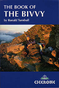
 I'd still like to get a bivvy though. A year or so ago, I read Ronald Turnbull's The Book of the Bivvy and found it an informative and interesting read. More recently Alastair Humphreys has had a bit of debate on his website about which are the best bivvies to get.
Once I get one, then I'll have to think about where to take it to get the full bivvying overnight experience.
Once I get one, then I'll have to think about where to take it to get the full bivvying overnight experience.
Saturday, 11 June 2011
Other blogs and websites
There are a few websites and blogs that I monitor frequently. One is Alastair Humphreys' website. He pushes the whole motivation thing a bit heavily at times, but he is quite inspirational and I've picked up a few ideas from him. When I checked out his site today he had a link to a website belonging to a Swiss couple who spent eight years cycling round the world, more than a year of which was in Japan. This section of their website seemed quite interesting as cycling in Japan is an idea that's starting to ferment at the back of my mind. Unfortunately there wasn't a lot of detail, but they do have some amazing photos.
Another website I check regularly is that of the Walking Englishman. He really inspires me to create my own website though I know I'll never be in his league. At the moment he's a few weeks in to an 80 day, 1000 mile walk through Scotland and England. Most days he's updating a blog about it. The update I read today was about the small part of the Great Glen Way he's walking, including Neptune's Steps and the route into Fort William. If I walk the GGW in the summer I'll be doing it the other way round to this, but it's still more information for me that will help me to prepare.
I do like it when the blogs and websites I look at link in to what I'm doing at the moment.
http://www.alastairhumphreys.com/
http://veraluc.com/velo_le_voyage.php?lang=eng
http://www.walkingenglishman.com/
http://www.1000milewalk.co.uk/2011/06/09/accomplishment/
Another website I check regularly is that of the Walking Englishman. He really inspires me to create my own website though I know I'll never be in his league. At the moment he's a few weeks in to an 80 day, 1000 mile walk through Scotland and England. Most days he's updating a blog about it. The update I read today was about the small part of the Great Glen Way he's walking, including Neptune's Steps and the route into Fort William. If I walk the GGW in the summer I'll be doing it the other way round to this, but it's still more information for me that will help me to prepare.
I do like it when the blogs and websites I look at link in to what I'm doing at the moment.
http://www.alastairhumphreys.com/
http://veraluc.com/velo_le_voyage.php?lang=eng
http://www.walkingenglishman.com/
http://www.1000milewalk.co.uk/2011/06/09/accomplishment/
Friday, 10 June 2011
Julia Bradbury's Canal Walks
Julia Bradbury isn't my favourite walker and I'd rather be out walking myself than watching a tv programme about it. But occasionally she walks in a place I'm particularly interested in and so I'll download the programme on iplayer and then try to make enough effort to actually watch it. She's now doing a series on canal walks and the first was featuring the Caledonian Canal and the first part of the Great Glen Way. As this is where I'm hoping to walk in the summer I thought I should download it.
I've just watched the programme and I did find it quite worthwhile. It's useful to see what the places actually look like as then I'll be better prepared when I come to walk in them. She also gave some history about the canal which was interesting.
The canal was built by Thomas Telford and was on a scale that hadn't been seen before. It joined up the west coast to the east coast utilising the lochs that were already there. It was the first canal big enough to take more than just barges and was meant to aid fishing boats in their journey from coast to coast as it would save them having to go round the more dangerous coast to the north of Scotland. The canal got public funding which was also a first, because the government were keen to invest in the area to stop migration and encourage business by making the area more economically viable.
The canal ended up being way over budget and taking about three times as long as originally planned. Some things never change! By the time it was ready and functional advances in shipping meant the north coast could be more easily and safely tackled and the railway system was taking over from the canals. So this amazing example of engineering was never used to its full potential and ended up being a bit of a white elephant. It looks stunning though and provides a great walk or cycle and is set to be the UK's first long distance canoe trail as well. So at least it's appreciated and well used even if not for the original reason!
I've just watched the programme and I did find it quite worthwhile. It's useful to see what the places actually look like as then I'll be better prepared when I come to walk in them. She also gave some history about the canal which was interesting.
The canal was built by Thomas Telford and was on a scale that hadn't been seen before. It joined up the west coast to the east coast utilising the lochs that were already there. It was the first canal big enough to take more than just barges and was meant to aid fishing boats in their journey from coast to coast as it would save them having to go round the more dangerous coast to the north of Scotland. The canal got public funding which was also a first, because the government were keen to invest in the area to stop migration and encourage business by making the area more economically viable.
The canal ended up being way over budget and taking about three times as long as originally planned. Some things never change! By the time it was ready and functional advances in shipping meant the north coast could be more easily and safely tackled and the railway system was taking over from the canals. So this amazing example of engineering was never used to its full potential and ended up being a bit of a white elephant. It looks stunning though and provides a great walk or cycle and is set to be the UK's first long distance canoe trail as well. So at least it's appreciated and well used even if not for the original reason!
Monday, 6 June 2011
Great Glen Way
For my long distance walk I've decided to walk the Great Glen Way. For it to count as the challenge on my list I have to complete it in one go and not just as a series of individual day walks. I also want to do it whilst carrying all my own gear. As I'll be camping each night I'll need to carry a tent, Thermarest, sleeping bag, stove, pans, etc as well as few toiletries and a couple of changes of clothes.
My walking in Exmoor last week was the start of my training towards this. I've been worried about my knees and whether or not they'll hold up to walking consecutively over a week. I'm also not sure if I'm fit enough and strong enough to carry all my gear. I tried to carry a fairly heavy bag each day I walked in Exmoor and after a while I did 'forget' I was wearing it. My bag on the GGW will be a lot heavier though and more bulky, so I'll have to do some training with this too.
My knees are going to be the biggest problem. I had to take two rest days in Exmoor. Each time was after a 15 mile walk with a lot of descent. I'm not too bad on the uphills - I can take short breather breaks if I need them - but the downhills are real killers. I walked slowly and used two poles but still had a lot of pain and swelling and later on stiffness in my knee joints.
One of the reasons I've chosen the GGW is because it's only 73 miles so I should be able to keep most of my walks along it to a 10 mile maximum. Also, the first few days walking will be fairly flat. By the time I hit the descents I should have a lighter pack (I will have eaten away at the weight) and be more than half way there. I'll take my poles and a stash of ibuprofen and will hopefully be able to complete it.
I'd like to combine my wild camping task with the long distance walking task. There are actual 'official' wild camps at some places along the route. Do they still count if they're official? On some nights I will have to find my own wild camp though, so whether or not the official ones count, I'll still be completing this task.
I've been googling the GGW to try to get as much information on it as possible. I've found a detailed blog from a few years ago, some general information sites and a very good photo diary on flikr. The photo diary in particular is good because it means I can see what the various bits of the route look like and how feasible it will be to camp along the way.
Now I just have to do more training, get a map and a guidebook, sort out train tickets and arrange to leave my car with a friend in Glasgow.
My walking in Exmoor last week was the start of my training towards this. I've been worried about my knees and whether or not they'll hold up to walking consecutively over a week. I'm also not sure if I'm fit enough and strong enough to carry all my gear. I tried to carry a fairly heavy bag each day I walked in Exmoor and after a while I did 'forget' I was wearing it. My bag on the GGW will be a lot heavier though and more bulky, so I'll have to do some training with this too.
My knees are going to be the biggest problem. I had to take two rest days in Exmoor. Each time was after a 15 mile walk with a lot of descent. I'm not too bad on the uphills - I can take short breather breaks if I need them - but the downhills are real killers. I walked slowly and used two poles but still had a lot of pain and swelling and later on stiffness in my knee joints.
One of the reasons I've chosen the GGW is because it's only 73 miles so I should be able to keep most of my walks along it to a 10 mile maximum. Also, the first few days walking will be fairly flat. By the time I hit the descents I should have a lighter pack (I will have eaten away at the weight) and be more than half way there. I'll take my poles and a stash of ibuprofen and will hopefully be able to complete it.
I'd like to combine my wild camping task with the long distance walking task. There are actual 'official' wild camps at some places along the route. Do they still count if they're official? On some nights I will have to find my own wild camp though, so whether or not the official ones count, I'll still be completing this task.
I've been googling the GGW to try to get as much information on it as possible. I've found a detailed blog from a few years ago, some general information sites and a very good photo diary on flikr. The photo diary in particular is good because it means I can see what the various bits of the route look like and how feasible it will be to camp along the way.
Now I just have to do more training, get a map and a guidebook, sort out train tickets and arrange to leave my car with a friend in Glasgow.
Sunday, 5 June 2011
Wild Camping
As I walked along the Exmoor stretch of the South West Coastal Path I thought about how I would do the walk if I was doing it in one go rather than as a series of day walks. Most camp sites are a bit of the way off the path so would add a few miles walking to each day. Not something I'd particularly want to do. There was actually one campsite that the path went through and it had signs up saying hikers could camp for one night only on their way through for £4. Usual price being a mind-boggling £13 a night! It did say that this was for 2 people, but as there was nothing about prices for individuals it sounded like if I'd stayed here instead of Porlock I'd have had to pay for a non-existent second person as well as myself.
But, to get back to the main point, if I was walking this section in one go I would have had to wild camp on some of the nights. Much of the walking was through wooded areas that sloped upwards and downwards either side of the path, so there was really nowhere to fit a tent. This was particularly true on the first day's walk when the only flat, clear bit seemed to be at the section where the path crossed the path leading to County Gate. This was a bit of busy area and so not ideal.
Between Minehead and Porlock it would have been possible to camp on the moorland, but this would have meant a very short day's walking. The other stretches of the walk were similar in not having many appropriately placed areas to wild camp in.
I'm planning to wild camp on the Great Glen Way in the summer, so I hope it's easier to find places than this!
But, to get back to the main point, if I was walking this section in one go I would have had to wild camp on some of the nights. Much of the walking was through wooded areas that sloped upwards and downwards either side of the path, so there was really nowhere to fit a tent. This was particularly true on the first day's walk when the only flat, clear bit seemed to be at the section where the path crossed the path leading to County Gate. This was a bit of busy area and so not ideal.
Between Minehead and Porlock it would have been possible to camp on the moorland, but this would have meant a very short day's walking. The other stretches of the walk were similar in not having many appropriately placed areas to wild camp in.
I'm planning to wild camp on the Great Glen Way in the summer, so I hope it's easier to find places than this!
Subscribe to:
Posts (Atom)